Blog Layout
Safeguarding Miners: The Role of Advanced Environmental Monitoring Systems in Mining Operations
Ian Jansen • Nov 08, 2023
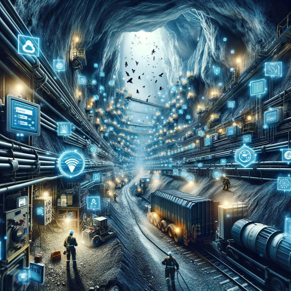
In the demanding and dynamic world of mining, safety and operational efficiency are paramount. The introduction of the ENVIRONMENT MANAGEMENT SYSTEM (EMS) marks a significant advancement in ensuring miner safety, especially post-blasting in underground mines. Typically, a 30-minute re-entry limit with ventilation is mandated to remove harmful gases, but continuous monitoring has been a gap – one that EMS effectively fills.
Active Gas Monitoring for Enhanced Safety
EMS provides an active gas monitoring system, a crucial tool for real-time tracking of airflow, noxious gases, and blast detection. This continuous monitoring is pivotal in maintaining a safe working environment, significantly reducing the risks associated with underground mining.
Digital Terrain: Integrating Technology for Operational Efficiency
Digital Terrain is a comprehensive system connecting various mine devices to streamline operations. It integrates fan start relays, VSD drives, pump controls, tank level sensors, and more for efficient management of essential mining functions. Additionally, it includes emergency systems like remote stench gas release, vital for critical situations.
GeoMoby Partnership: Tracking for Safety and Efficiency
Through our partnership with GeoMoby, we offer advanced vehicle and personal tracking. This system, combined with Simbio Plod Plan and Manage, creates a robust interval control system. It tracks truck cycles, drill meters, and manages consumables, further automating ventilation and warning systems for both safety and operational efficiency.
Looking Ahead: The Future of Mining Technology
The future of mining is unequivocally heading towards more integrated and intelligent systems. The integration of IoT devices, AI, and advanced analytics will continue to enhance safety and operational efficiency. This trend promises a mining ecosystem that is not only safer but also more productive and cost-effective.
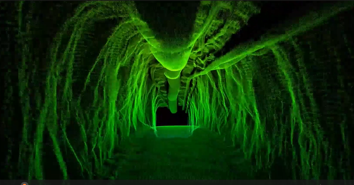
An accurate Digital model for the main decline of an underground mining operation is important and offers valuable benefits for mining companies and operators. From optimising resource extraction to enhancing safety protocols, the meticulous mapping of main declines serves as a cornerstone for efficient and sustainable mining practices. Let's explore some of the key advantages and benefits: 1. Enhanced Safety Protocols: Accurate mapping of the main decline enables mining companies to identify potential safety hazards such as unstable ground conditions, geological faults, or reinforcement movements. By proactively addressing these risks, mining operators can implement robust safety protocols, reducing the likelihood of accidents or incidents and ensuring the well-being of personnel working in the area. 2. Improved Resource Optimization: Mapping the main decline provides valuable insights into the geological characteristics and mineralization patterns of the surrounding ore body. This information allows mining engineers to optimise resource extraction strategies, including the design of mining methods, stope layouts, and ore handling systems. By maximising resource recovery while minimising waste, mining companies can enhance operational efficiency and profitability. 3. Enhanced Operational Planning: Accurate mapping of the main decline facilitates comprehensive operational planning, including scheduling of drilling, blasting, and extraction activities. By visualising the spatial layout of the decline and associated infrastructure, mining operators can optimise workflows, streamline logistics, and minimise downtime, leading to improved productivity and cost-effectiveness. 4. Facilitates Infrastructure Development: Detailed mapping of the main decline provides essential data for the design and construction of infrastructure such as ventilation systems, service lines into the operation, and support structures. By accurately assessing the spatial constraints and geological conditions of the decline, mining engineers can optimise the layout and configuration of infrastructure elements, ensuring efficient operation and maintenance throughout the mine's lifespan. 5. Supports Regulatory Compliance: Mining companies are subject to stringent regulatory requirements governing safety, environmental protection, and resource management. Accurate mapping of the main decline helps ensure compliance with these regulations by providing comprehensive documentation of underground workings, geological features, and safety measures undertaken. This enables mining operators to demonstrate due diligence and accountability to regulatory authorities and stakeholders. Mapping the main decline of a mining operation is a strategic imperative that yields a multitude of benefits that Digital Terrain know and understand. By leveraging the insights gained from a digital twin generated through our Lidar services that seamlessly rolls into Maptek, Deswik and other mining software, mining managers and operators can navigate the path to success with confidence and foresight. Digital Terrain Digital Terrain have solutions that replace or augment existing capabilities for capturing, processing, analysis and reporting. We also offer onsite instruction and training where customers seek to build their own expertise. > Enjoy the sample video of our capabilities and contact David Juany for any comments, questions, or service information. david.Jaunay@digitalterrain.io or +61434317580 #lidar #autonomousdrones #slam #hovermap #scanning #underground #stope

Underground mining is a harsh environment to operate in, where the next decision can be the difference between continued progress or productivity halting delays. Often it is the ‘gut-feel’ or ‘intuition’ that results in pulling Lever A as opposed to Lever B, but when it is estimated that the average adult makes 35,000 decisions a day (Sollisch 2016), it is clear that not all of these can possibly be the optimal solution all of the time. Traditionally, data collection has been a lagged, cumbersome process, fraught with inaccuracies (poor radio communications, misplaced/damaged/destroyed paperwork), double handling (horizontally integrated systems) and delays (data entry occurs progressively by site administration on the following shift for the one preceding it). However, with the advent of digitization, this narrative is rapidly changing. Real-time data collection and analysis empower stakeholders to access accurate and timely information, enabling them to make informed de cisions on the fly. Coupled with Digital Terrain’s RDI-WRS Wireless Repeater System ( https://www.digitalterrain.io/revolutionising-underground-mining-with-wi-fi-mesh-technology ), Simbio PLOD can present decision makers within your business the information they need to execute your plans and achieve your goals. Digital Terrain‘s Simbio Core Suite (SCS) puts frontline personnel at the heart of their solution. Operators are empowered to capture their own data, in real-time, through the use of the Simbio PLOD app (available on Android and iOS). Each operator logs the progress of their shift as they complete their assigned tasks (using Simbio’s PLAN module) including Task Workplace Inspections (Take 5’s, Stop and Thinks, Safe Stops etc), Prestarts, Hazard Forms, Productive Time, Downtime, Maintenance Faults, Trigger Action Response Plan (TARP) workflow escalations and more. The Digital Terrain team is committed to ensure that your operation can hit the ground running from Day 1.